Oak/pinyon/juniper woodland on hills and mountains derived from granite, gneiss, and similar rocks
This large EU takes in the Catalinas and Rincons below the pines and above the palo verde, mesquite, and whitethorn acacia. It encircles the mountains at elevations ranging from 3900 to 7400 ft (1200-2300 m). It also encompasses around 5000 acres of the Coronado NF in the Little Rincons.
Perennial bunchgrasses and a mix of Emory oak, white oak, blue oak, juniper, and pinyon dominate this landscape. Oaks are the usual dominant and the pinyon or juniper may be absent. Manzanita and/or silktassel are also sometimes absent, often common, rarely co-dominant. (Manzanita and pinyon are more common in another, “rocky,” EU). Perennial grasses are often abundant, and, when considering all grass species together, they are often the dominant vegetation. They also burn: while hiking in 2009 from the rocky Hollin Basin to the grassy Molino Basin, it’s clear that the Aspen fire burned Molino yet spared Hollin.
Steep slopes are the norm, with 77 % of the slopes exceeding 18%. Not surprisingly, aspect plays a big role in the vegetation, with the south-facing slopes often holding less than 10% tree cover at the lowest EU elevations in places like Molino Basin and Sabino Basin. (see photo below)
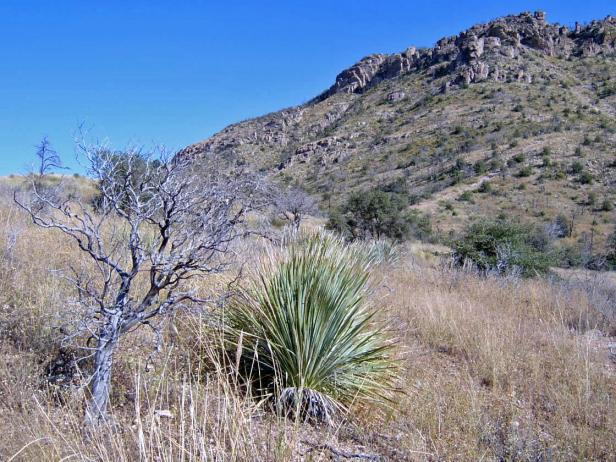
Catalinas, October, 2008, near Soldier Canyon and the old prison camp, at Gordon Hirabayashi Recreation Site. View is east, at 4850 ft, of an area burned in 2003 Aspen fire. Foreground slope is south-facing, with a 1-4% cover (each) of Emory oak, juniper, sotol, manzanita, silktassel, and beargrass. Bunchgrasses are common, along with annual comps like camphorweed (Heterotheca subaxillaris) and woody-aster (Xylorhiza gracilis).
At the opposite extreme are north-facing slopes at the highest elevations, where tree cover is 25-39%. Along toeslopes the cover can exceed 40%. (photo below)
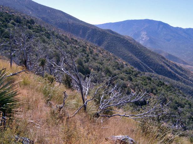
Catalinas, October, 2008, at 6400 ft., looking south up the CDO from Oracle Ridge, towards Mt. Lemmon (back right) and Rice Peak (back left). The unburned north slope of Rice Peak (back middle) holds relatively dense (25-40% cover) white and netleaf oak and alligator juniper. The burned slope in the foreground holds many oaks that are resprouting and look to replace juniper in the short term. Bunchgrasses are abundant. Silktassel is common. Manzanita is absent at this site, but common at the foot of slope, near the confluence of the east and west forks of CDO.
Most of the EU, however, more closely resembles the example (below) from the north side of the Catalinas. Tree cover varies with aspect and position along the slope.
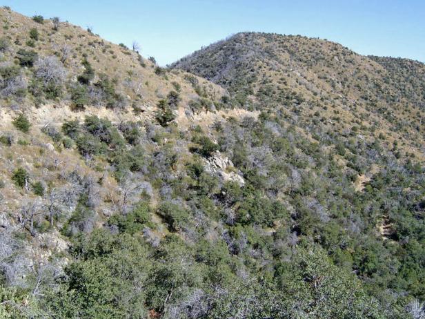
Catalinas, Oracle Control Road, 6100 ft., October 2008. View east to south-facing slope of Lombar Hill, with co-dominants Emory oak, white oak, and silktassel.
Flats make up only 2% of this EU. If they hold deeper soils, they often support mesquite and Mimosa biuncifera (wait-a-minute), in addition to the usual oaks (see below).
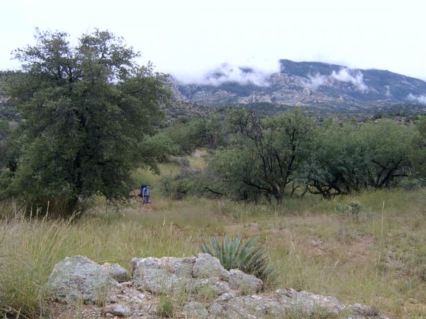
Rincons, August 2008, 4700 ft., near Park Tank and Italian Springs Trail. View south to cloud-draped Mica Mountain. Mesquite (right) and Emory oak (left). White oak joins the Emory and junipers on the north-facing slopes in background. Bunchgrasses include sideoats and tanglehead.
Desired Conditions
Desired conditions are adapted from Madrean encinal woodland, mid-scale desired condition statements in March 2010 Coronado National Forest planning documents.
The size and number of patches of dense trees varies depending mostly on aspect, and to a lesser degree disturbance, soil type, and site productivity. Patch sizes vary, but are mostly tens of acres. Grasses, forbs, shrubs, tree litter, and small trees provide fuel for the natural fire regime with a greater proportion of the ground cover as grasses and forbs as opposed to litter. Vegetation structure in the wildland urban interface (WUI) has a broad mix of different landscapes, such as open areas and scattered groups or clumps of woodland tree species.
Historic Mean Fire Return Interval (Schussman et al. 2006 literature review)
2.5-10 years for Madrean encinal woodland
Primary treatment options (estimated representative project size range):
- Wildland fire: Prescribed fire and/or wildfire to maintain openings, reduce ground fuels, and site prep (1,000 to 30,000 acres per project)
- First-entry mechanical treatments to prepare for fire reintroduction (mastication/crushing, pushing) (up to 2,500 acres per project)
- Fuelwood sales (smaller diameter, including aspens) to reduce fuel loading (up to 300 acres per project)
Supplemental treatment options (estimated representative project size range):
- Thinning to maintain openings and around developments for safety-related fuel reduction (up to 500 acres per project)
- Herbicide treatment for exotics and shrub management to maintain openings (up to 1,000 acres per project)
Other considerations
May be wilderness considerations with treatments
Other Vegetation Classifications:
Areas (polygons) mapped within this EU