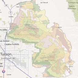
Landscape Types
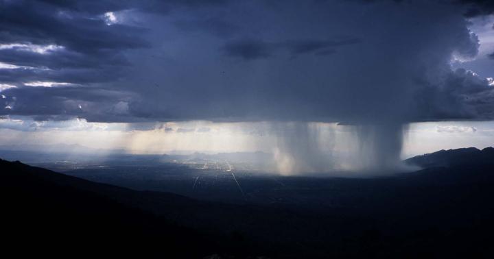
Summer storm over Sabino Canyon, viewed from the Rincons, with Tucson in the distance. Photo by Jim Malusa.
The landscape of the Catalinas and Rincons has been mapped according to several different criteria.
Ecological Units (EUs) are patches of the landscape that share similar vegetation cover. Land Type Associations (LTAs) are areas that share similar geology, soils and landforms. The areas mapped according to these two criteria are dissimilar, and in both cases the units assigned to the same category might not be contiguous. Ecological Land Types (ELTs) are the lowest level of mapping, where each unit is a single area with both a common underlying geology, similar landform, and similar vegetation cover.
There are index maps for each mapping criterion, where you can click to bring up more information about specific mapping units, and also textual indexes arranged by the names of each unit.
The data used to make the following maps and other FireScape products (e.g. fuel models, fire behavior models) are available. Email azfirescape@cals.arizona.edu with your request.