Chihuahuan desert on old eroded lakebed and river terraces with saline and gypsum rich soils
The terraces along the San Pedro between Benson and ‘The Narrows’ are either eroded into steep badlands (6% of the total land area) or form gently sloping benches and nearly level tablelands and valleys. The badlands are notable for the lack of whitethorn (at least in the location visited); instead the crumbling slopes are dominated by creosote, tarbush, mesquite, and saltbush. But the level terrain is dominated by whitethorn and mesquite, 3m and 5m tall, and typically combining for 15-24% cover. Prickly pear and catclaw are common associates. Grasses, especially tobosa and bush muhly, combine for another 5-9% cover, but the distribution is heavily skewed towards swales. Where ridges rise high enough to escape night freezes, blue palo verde and saguaro are present, but not common, and often live in the company of creosote and oreganillo.
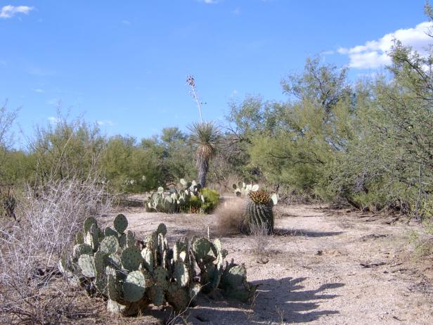
Photo Point 121, 13 miles north of Benson, off Ocotillo Road, 1 mile west of San Pedro, 3600 feet. Mesquite and whitethorn dominate, and prickly pear and catclaw are common associates.
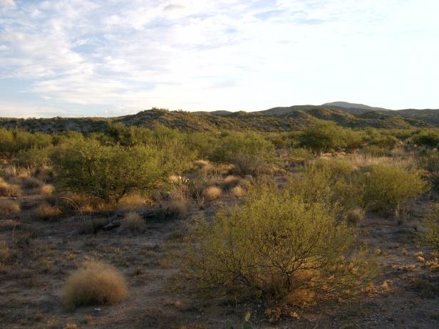
Photo Point 61, 21 miles north of Benson, clumps of bush muhly grass grow amid mesquite and whitethorn. The ridge in the background is also part of the EU, and supports mostly whitethorn and creosote bush. Yucca elata and catclaw are common but not abundant. The perennial grass, bush muhly, covers 1-5% at the photo site.
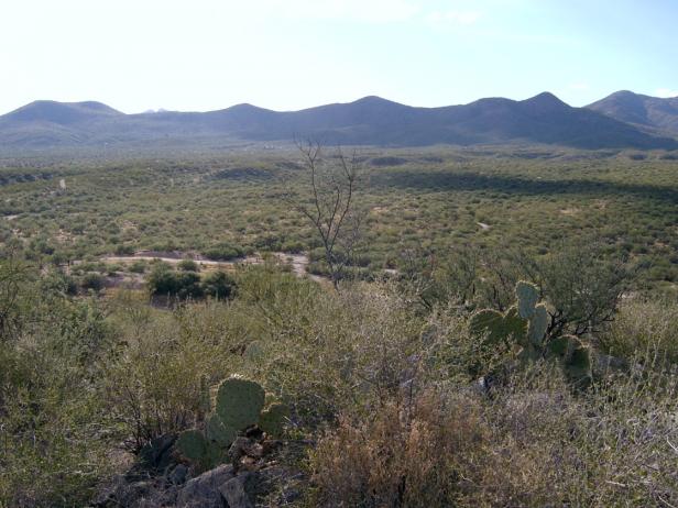
Photo Point 78, 13 miles north of Benson, above Ocotillo Road, 3700 feet. Looking west from a ridge, the valley below is within this EU, but the steep hills in the background are not. The valley floor co-dominants are whitethorn and mesquite , combining for 20-30% cover. Yucca elata, creosote bush, and catclaw are common but not abundant. The swales hold tobosa grass and bush muhly. The small ridges are dominated by whitethorn and oreganillo, with up to 5% cover, and up to 10% cover of prickly pear cactus. Blue paloverde and saguaro are occasionally present, but uncommon. On some ridges, creosote bush is co-dominant with whitethorn.
Desired Conditions
Desired conditions are adapted from Desert, mid-scale desired condition statements in March 2010 Coronado National Forest planning documents.
Fires are rare. Native species are present with no signs of soil compaction or accelerated erosion. A mix of shrubs, succulents, and grass evident.
Primary treatment options (representative project size range):
- Prescribed fire and/or wildfire to maintain openings, reduce ground fuels, and site prep (1,000 to 30,000 acres per project)
Supplemental treatment options (representative historic project size range):
- First-entry mechanical treatments to prepare for fire reintroduction (mastication/crushing, pushing, thinning) (up to 2,500 acres per project)
- Thinning around developments for safety-related fuel reduction (up to 500 acres per project)
- Cut and scatter brush along trails (up to 500 acres per project)
- Herbicide and mechanical treatment for exotics and shrub management (to maintain
- openings) (up to 1,000 acres per project)
- Fuelwood sales (smaller diameter, including aspens) to reduce fuel loading (up to 300 acres per project)
Other considerations:
May be wilderness considerations with treatments
Other vegetation classifications: