Chihuahuan desert on hills and mountians derived from limestone and associated rocks
This EU is weakly united by geology and topography: hills with obvious limestone. The hills are neither large nor steep — only 36% of the EU has slopes exceeding 18%. The EU is in two parts: alongside Alder Canyon in the Catalinas, and several scattered ELTs between the Rincons and I-10.
In two out of three sites visited, whitethorn acacia is the clear dominant; in the third, whitethorn was co-dominant with creosote. Grasses were abundant in two sites, and nearly absent in a third. Blue palo verde, mesquite, prickly pear were common associates in two sites. Beyond this commonality, there was diversity, as seen in the photos below.
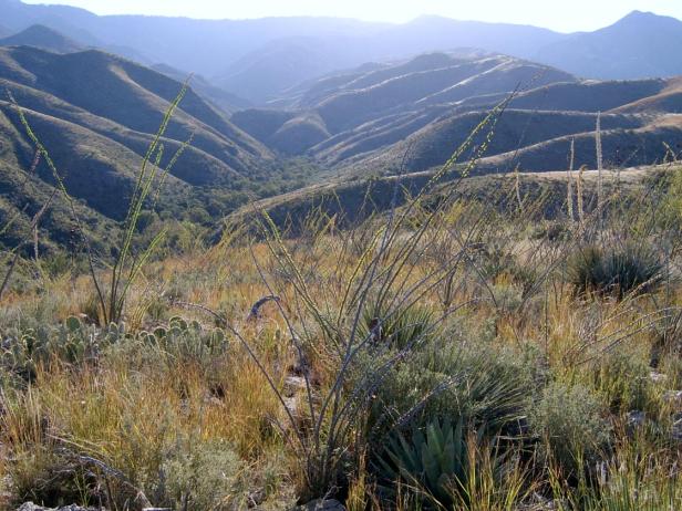
Photo Point 168, Catalinas, looking SW up Alder Canyon, 4700 ft, October 2008. Whitethorn is the dominant, with 15-25% cover, with abundant tanglehead grass, sandpaper bush, fairyduster, ocotillo, and sotol.
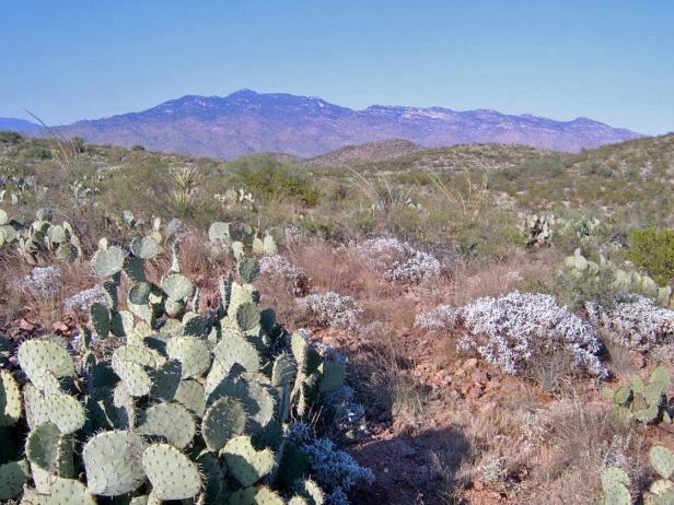
Photo Point 144, south side of Rincons, 3600 feet, September, 2008. Whitethorn is the dominant shrub. Common associates include Zinnia, prickly pear, brittle bush, mariola and blue palo verde.
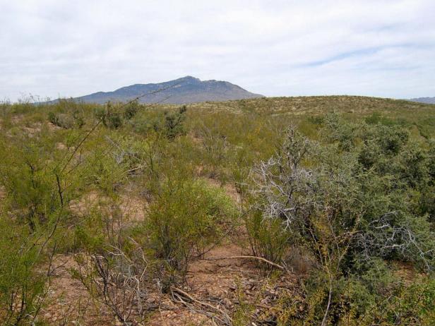
Photo Point 70, near Mescal interchange on I-10, south side of Rincons, 4200 ft, September 2007. Creosote and whitethorn share dominance, each with 5-9% cover. Common associates: Condalia, littleleaf sumac, and blue palo verde. Grasses were conspicuously absent.
Desired Conditions
Desired conditions are adapted from Desert, mid-scale desired condition statements in March 2010 Coronado National Forest planning documents.
Fires are rare. Native species are present with no signs of soil compaction or accelerated erosion. A mix of shrubs, succulents, and grass evident.
Primary treatment options (representative project size range):
- Prescribed fire and/or wildfire to maintain openings, reduce ground fuels, and site prep (1,000 to 30,000 acres per project)
Supplemental treatment options (representative project size range):
- First-entry mechanical treatments to prepare for fire reintroduction (mastication/crushing, pushing, thinning) (up to 2,500 acres per project)
- Thinning around developments for safety-related fuel reduction (up to 500 acres per project)
- Cut and scatter brush along trails (up to 500 acres per project)
- Herbicide and mechanical treatment for exotics and shrub management (to maintain
- openings) (up to 1,000 acres per project)
- Fuelwood sales (smaller diameter, including aspens) to reduce fuel loading (up to 300 acres per project)
Other considerations:
May be wilderness considerations with treatments
Other vegetation classifications:
Ecological System as defined by the Southwest Regional Gap Analysis Project
Biome after Brown, Lowe and Pase (1979)
143.1 Scrub-Grassland (Semidesert Grassland)
Community after Whittaker and Niering (1975)
Desert grassland