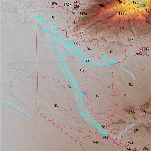
ELT 3a
Soil Summary:
very deep, textures vary widely and soils are often stratified – very gravelly fine sand to loam surfaces with extremely gravelly sand to silty clay loam layers below, limy, no or little development; dominated by Pima County soil survey map units 5 (Arizo-Riverwash complex, 0 to 3 percent), 3 (Anthony fine sandy loam, 0 to 3 percent), and 30 (Glendale silt loam, 0 to 3 percent). These units comprise 41, 24, and 24% of the ELT, respectively
Geologic Materials:
river alluvium associated with active channel and Holocene terraces of Pantano Wash (Qyr), modern channel deposits (Qycr, Qyc), Holocene river deposits (Qyr, Qy2), and Holocene piedmont alluvium (Qy) which comprise 40%, 23%, 19% and 6% of the unit, respectively
Landforms:
coarsely dissected, weakly to moderately incised mainly on river terrace breaks; terraces themselves show little dissection