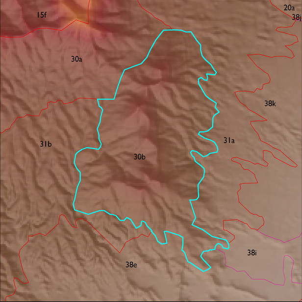
ELT 30b
Soil Summary:
dominant soils are very shallow and shallow to granite and similar rocks; very cobbly loams or very gravelly sandy loams throughout, some soils with gravelly clay loam surfaces and gravelly clay and clay subsoils; no lime; no to moderate soil development (clay accumulation); dominated by Cochise County Northeastern Part soil survey map units 71 (Romero- Rock outcrop complex, 5 to 60 percent slopes) and 62 (Nolam-Stronghold complex, 5 to 30 percent slopes). These unit comprise 91% and 9% of the ELT, respectively
Geologic Materials:
alluvium, colluvium and residuum associated with the Johnny Lyon Granodiorite (Xgi) which comprises 92% of the unit
Landforms:
moderately to finely dissected, weakly to moderately incised mountain slopes