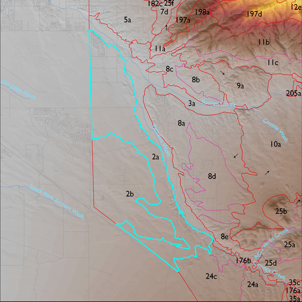
ELT 2a
Soil Summary:
very deep, very to extremely gravelly sandy loams, loams and clay loams except in drainages which have silty clay, gravelly clay and gravelly sandy clay loam subsoils ; lime throughout or prevalent at a shallow depth, except in low areas and drainages; well developed (lime and or clay accumulation); dominated by Pima County soil survey map units 72 (Sahuarita soils, Mohave soils and Urban land, 1 to 5 percent), 60 (Pinaleno-Stagecoach complex, 5 to 16 percent), 34 (Hantz loam, 0 to 1 percent), 81 (Tubac gravelly loam, 1 to 8 percent), and 62 (Pinaleno very cobbly sandy loam, 1 to 8 percent slopes). These units comprise 32, 21, 13, 13, and 12% of the ELT, respectively
Geologic Materials:
alluvium and residuum associated with Quaternary and Tertiary sandstone, siltstone and conglomerate, undivided (QTs), Pliocene and Pleistocene river deposits (Qir, Qyr, QTsr, Qy2), and Holocene and Pleistocene piedmont alluvium (Qy, Qi, Qi1, Qi2, Qi3)which comprise 48%, 32%, and 11% of the unit, respectively
Landforms:
coarsely dissected, weakly to moderately incised fan and pediment surfaces except adjacent to Pantano Wash which is moderately to finely dissected and moderately to deeply incised