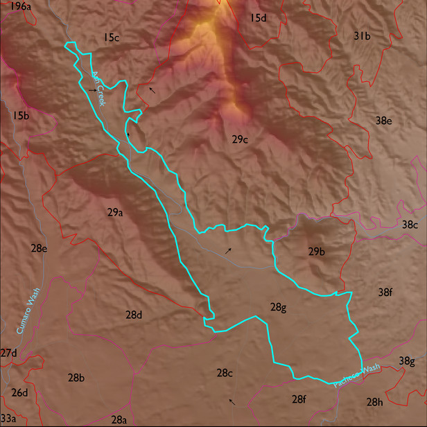
ELT 28g
Soil Summary:
soil survey data is incomplete for a small portion of this unit but the dominant soils are very deep, very gravelly loamy sand and fine sandy loam to loam surfaces over gravelly, very gravelly and extremely gravelly sandy loam or clay, clay loam, sandy clay loam and gravelly clay loam subsurface layers, limy throughout or roughly a foot or more to lime, moderate to strong development (lime and clay accumulation) ; unit is dominated by Cochise County, Northwestern Part soil survey unit 79 (Stronghold-McAllister-Elgin complex, 5 to 25 percent slopes) and 62 (Nolam-Stronghold complex, 5 to 30 percent slopes). They comprise 50% and 22% of the covered area, respectively
Geologic Materials:
alluvium and residuum associated with sandstone, siltstone and conglomerate, undivided (QTs); middle to late Pleistocene piedmont alluvium, undivided (Qi); Holocene piedmont alluvium, undivided (Qy); and modern channel deposits (Qyc) which comprise 62%, 13%, 12% and 7% of the unit, respectively
Landforms:
moderately to finely dissected, weakly to moderately incised fan and pediment surfaces