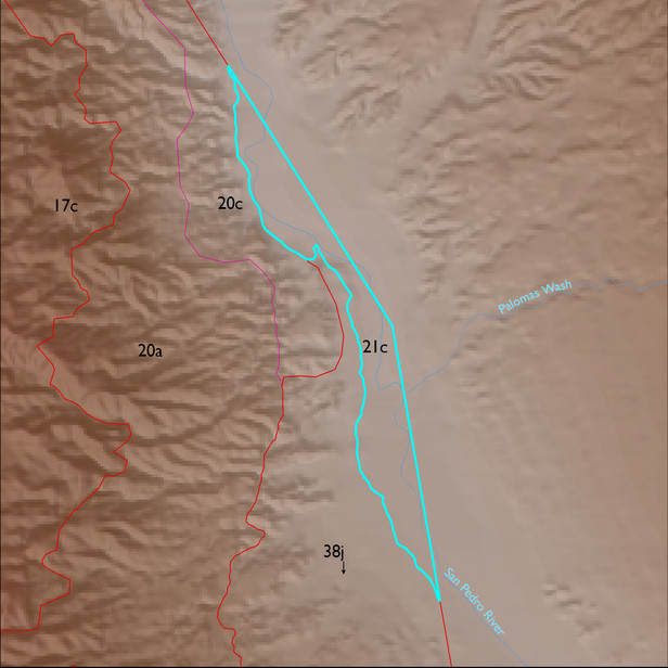
ELT 21c
Soil Summary:
very deep, textures vary widely and soils are often stratified – very fine sandy loam to silty clay surfaces with very gravelly coarse sand to silty clay layers below, limy, no or little development, some high water tables on lower terraces; dominated by Cochise County, Northwestern Part soil survey units 40 (Gila-Glendale complex, Chihuahuan, 0 to 2 percent slopes), 48 (Hantz complex,Chihuahuan, 0 to 2 percent), 17 (Cascabel, Quiburi soils, and Riverwash, Chihuahuan, 0 to 5 percent slopes), and 19 (Casabel, Quiburi, and Typic Fluvaquents soils and Water, Chihuahuan, 0 to 5 percent slopes). These units comprise 41%, 29%, 18%, and 10% of the ELT, respectively
Geologic Materials:
river alluvium associated with late Holocene river deposits (Qy2r) and late Holocene alluvium (Qy2) which comprise 61% and 38% of the ELT, respectively
Landforms:
coarsely dissected, weakly to moderately incised mainly on river terrace breaks; terraces themselves show little dissection