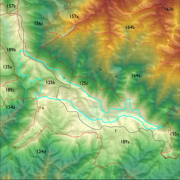
ELT 125b
Description:
Inspiration Rock to Mt. Bigelow, including Bear Wallow
Area:
311 ha
Area in acres:
769 acres Soil Summary:
detailed soil survey information is not available for this unit; correlates with GES unit 476 characterized by extremely cobbly sandy loams shallow to deep to granite or granite-like bedrock, acid soils lacking lime throughout, minimal soil development, and associated rock outcroppings
Geologic Materials:
slope alluvium, colluvium and residuum associated with Middle Proterozoic Apache Group and Troy Quartzite (Ya). It comprises 95% of the unit
Landforms:
moderately dissected mountain slopes with shallow to moderate drainage incision
An additional note on the ecological systems classification: LANDFIRE identifies much of this Madrean Pine-Oak Forest as “Southern Rocky Mountain Ponderosa Pine.” Although this is an accepted name, Nature Serve’s description places this ecological system to the north of our study area.
Landform position classes and corresponding vegetation*
| Landform Class | Area |
Percentage of ELT |
Vegetation and notes | |
|---|---|---|---|---|
| gently sloping ridges and hills | 37 ha | 12 |
Doug fir/SW pine/Ponderosa pine/white fir |
|
| very moist steep slopes | 45 ha | 15 |
Doug fir/white fir/SW pine/bigtooth maple |
|
| moderately dry steep slopes | 91 ha | 29 |
Ponderosa pine/SW pine/silverleaf oak/netleaf oak |
|
| moderately moist steep slopes | 112 ha | 36 |
Doug fir/SW pine/white fir |
|
| very dry steep slopes | 21 ha | 7 |
Ponderosa pine/SW pine/silverleaf oak/netleaf oak and Ceanothus |
Region 3 Mid-Scale Vegetation Cover Classes
| Cover Class | Area |
Percentage of ELT |
|
|---|---|---|---|
| Sparsely vegetated, <10% vegetative cover (includes areas of high severity burns, 2002-03) | 1 ha | 1 | |
| Tree cc 10 - 29.9% | 6 ha | 2 | |
| Tree cc 30+% | 303 ha | 97 |
