Photo Point 079
Description:
Looking south from Interstate 10 a mile east of Cienega Creek.
Photo:
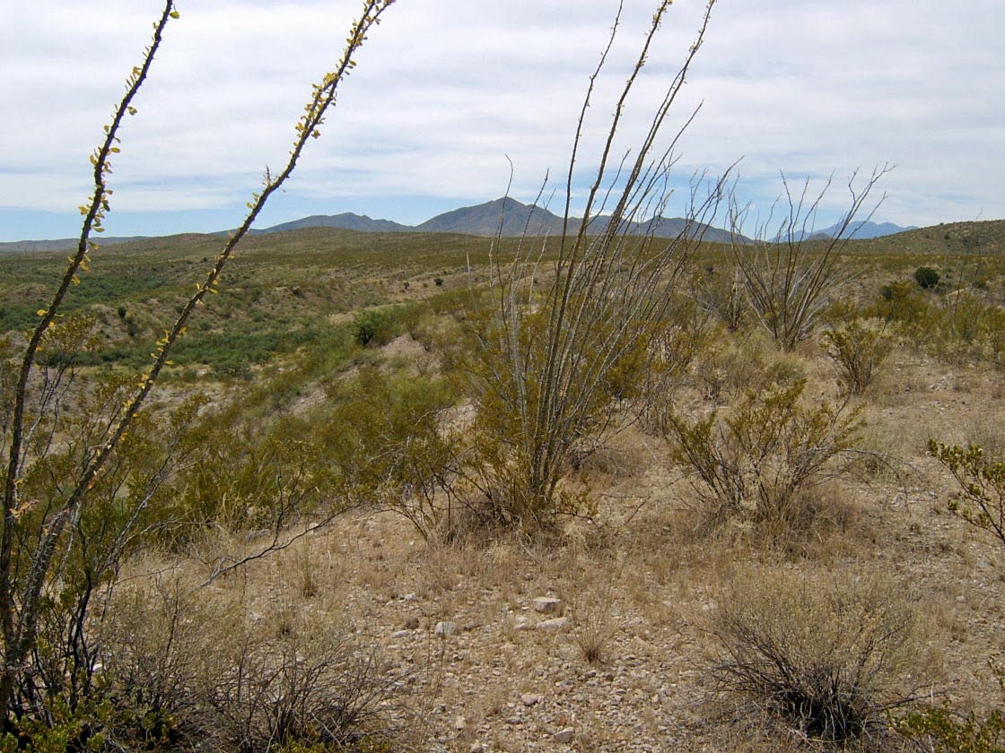
The ridges of this LTA are dominated by creosote, ocotillo, and mariola. The swales are primarily mesquite, whitethorn, and creosote. Common small shrubs include zinnia, Hibiscus denudatus, fairy duster, and Mendora scabra. Common grasses include bush muhly, fluffgrass, and tobosa grass.
Photo date:
September 25, 2007
Photo credit:
Jim Malusa
View looking:
S Vegetation:
| Species | Relative abundance | Cover | Mean height in meters and notes | |
|---|---|---|---|---|
| Fouquieria splendens | common | 1-4% |
ridges |
|
| Parthenium incanum | co-dominant | 5-9% |
ridges |
|
| Larrea tridentata | co-dominant | 5-9% |
ridges and swales |
|
| Zinnia acerosa | common | 1-4% | ||
| Acacia constricta | co-dominant | 5-9% |
swales |
|
| Hibiscus denudatus | common | 1-4% | ||
| Calliandra eriophylla | common | 1-4% |
| Species | Relative abundance | Cover | Mean height in meters and notes | |
|---|---|---|---|---|
| Prosopis velutina | co-dominant | 5-9% |
swales |
| Species | Relative abundance | Cover | Mean height in meters and notes | |
|---|---|---|---|---|
| Mendora scabra | common | 1-4% |
| Species | Relative abundance | Cover | Mean height in meters and notes | |
|---|---|---|---|---|
| Muhlenbergia porteri | uncommon | <1% | ||
| Tridens pulchellus | uncommon | <1% | ||
| Pleuraphis mutica | uncommon | <1% | ||
| Eragrostis lehmanniana | uncommon | <1% |