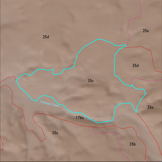
ELT 35c
Soil Summary:
very deep, very gravelly fine sand over stratified sands, fine sands, gravelly coarse sands, etc., mixed limy and non-limy layers, little or no development; dominated by Pima County soil survey map unit 66 (Redington very gravelly fine sand, 3 to 50 percent slopes) which comprises 90% of the ELT
Geologic Materials:
alluvium, colluvium, and residuum associated with Lower Davidson Canyon facies, mixed conglomerate, reddish (Tpi); Cienega Creek middle to late Pleistocene terraces (Qir); old alluvium (QTs); Willow Canyon, Apache Canyon, and Schellenberger Canyon Formations (Kbs); late Holocene deposits in active stream channels and low terraces (Qy2); and Cienega Creek channel deposits and Holocene terraces (Qyr) which comprise 41%, 19%, 15%, 10%, 6% and 5% of the ELT, respectively
Landforms:
coarsely to moderately dissected, weakly to moderately incised fans, pediments and low hills