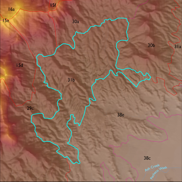
ELT 31b
Soil Summary:
dominant soils are very deep, very gravelly fine sandy loam over very gravelly sandy clay loam subsoils or very gravelly and gravelly sandy loam subsurface layers, lime within a foot of the soil surface or throughout, moderate development (clay and/or lime accumulation), other soils are very gravelly loamy sand over gravelly sandy loam and are limy throughout, moderate development (lime accumulation); unit is dominated by Cochise County, Northwestern Part soil survey units 62 (Nolam-Stronghold complex, 5 to 30 percent slopes) and 83 (Tombstone-Stronghold complex, 5 to 30 percent slopes). These units comprise 57% and 41% of the ELT, respectively
Geologic Materials:
alluvium and residuum associated with Pliocene-Pleistocene basin fill conglomerates (QTc); biotite granitoids of Happy Valley area); and early Proterozoic Pinal Schist (Xp) which comprise 62%, 16% and 8% of the unit, respectively
Landforms:
moderately to finely dissected, weakly to moderately incised fan and pediment surfaces